


Did Swissair Flight 111 land at an Airbase?
Last Updated on October 24, 2020 by Hamad Subani
Conflicting Witness Testimony

In a conspiracy so big, witness testimony was expected to line up with the narrative being pushed. That after the last radio contact which took place as the plane entered Saint Margaret’s Bay, the plane was on fire. And did a dumb doughnut near Blandford and surrounding areas, where up to ten people witnessed the plane. The problem with these testimonies is that they are fairly contradictory.
For example, on 6th September 1998, Jo-Anne MacDonald of the Daily News reported that one witness near Blandford saw the plane on fire. To quote,
“There was a glow from the left wing back and flames in front of the left wing,” she said. “The whole plane was not on fire. I had a very clear view.” Little more than a minute later she heard it crash.
On 8th September 1998, the same witness claimed she had been misquoted. To quote Randy Jones of the Halifax Herald,
“It passed right over my house, about 800 feet up or a little bit more,” said Ms. Murphy who was interviewed by Transportation Safety Board investigators in the afternoon. Reports suggesting she saw the plane on fire in back of the wings are untrue, she said.
Other witnesses in Blandford claimed to have heard an explosion. To quote CNN on 3rd September 1998,
“We heard the sound of an engine going overhead and then shortly after we felt a large vibration on the house, almost as if someone was banging into the side of our house,” said Linda Farmer, who lives near the coast in Blandford, Nova Scotia.
“There was quite a terrible explosion, but there was no flame that we could see,” said Audrey Bachman, whose husband is a fisherman and is using his boat to help search for survivors.
To quote CNN again on 3rd September 1998,
“I thought at first it was a helicopter, all I heard was a big boom like a sonic boom. The plane went right over head, it was very, very low. It sounded terrible. I joked that it sounded like a UFO because it was just droning,” said Edie Boyle, a resident of nearby Blandford.
“It wasn’t the smooth sound of an airplane,” recalled Alberta Martin. “I heard the crash (and) a clap of thunder shook the house.”
The Daily News on 3rd September 1998 quoted another witness near Blandford. This time, the “explosion” had been replaced by a “thud.”
It was very loud, and then there was the thud, and it was just silent.”
To quote Lois Legge of the Halifax Herald on 13th November 1998 regarding what a Blandford resident went through,
When Swissair Flight 111 went down in waters near Jane Schnare’s house, the force of the crash shook the pictures off her walls.
Several other witnesses on tiny islands off Blandford reported similar things.
Whoops! A Bus Driver ruins everything

Looking at the earlier map, it seems the plane flew over the Indian Harbour region when it was headed to Halifax Airport. But after reversing course, it entered St. Margaret’s Bay and flew over Blandford before it crashed.
But a witness on the coast of Indian Harbour claimed that he saw SWR111 fly over Indian Harbour again after reversing course, and that it was headed towards Peggy’s Cove in the North-East. In other words, the plane was en route to CFB Shearwater in the North-East.
Harry Publicover was a school bus driver who along with his wife Shirley lived in Indian Harbour. To quote his wife Shirley,
“It was exactly 10:25 recalls Shirley. We came home with my sister and penned the front of the house. Then we heard a terrible noise. Suddenly appearing from behind the forest, we saw a plane skimming the tops trees, just above telephone lines. It happened in over our house. Exactly between the garage and the house. I was afraid for my life. “
To quote Harry,
The plane came in low over Indian Harbour…Heading from inland South West towards the sea, nose up, engines running smoothly, spot and egress lights out.
He claimed that it was flying very low (almost as high as two telephone poles) although it seemed to gain altitude as it headed towards Peggy’s Cove in the North-East. The red and blue blinkers were also turned off, which Harry had never seen before in an aircraft flying at night. The wheels were not yet down.
It didn’t have any exterior lights”, said Harry, “but the interior was lit up like a hotel. One could almost see the passengers through the portholes.”

Another witness, Juanita and her two friends, also saw the plane over Indian Harbour, Flying towards the sea. Sadly, Harry Publicover passed away in April 2002. And his statements in their original entirety can no longer be found on the web. Not even on archive.org
These seemingly innocuous observations threw a wrench into the intended coverup, and the Powers That Be had to “revise” the map of the flight path to accomodate Harry Publicover’s observation of the plane flying over the Indian Harbour Mainland towards the sea. The new “revised” flight path (see below) now shows the plane flying over the Indian Mainland. But not Eastwards towards Peggy’s Cove. Instead, the plane is shown to once again fly over Blandford and complete the crazy doughnut, thus staying consistent with the intended coverup and not raising questions about the eyewitness accounts at Blandford.

Around this time, the RCMP began warning witnesses not to give any statements to the media.
More Questions
But Harry Publicover’s statement raised a new set of questions.
As we are aware, a “revised” version of the flight path started appearing in the media. This revision was done to accomodate Harry Publicover’s account. But immediately after this map was released, another “revision” was released on 5th September 1998. (See below). Why was this second revision neccessary? Because in the earlier version, the loss of radio contact took place BEFORE the plane flew over Indian Harbour (according to ATC Halifax). We were told that the loss of radio contact was due to the fire causing the electrical system to fail. Harry Publicover on the other hand, claimed to have seen the cabin lit up like a hotel, which meant that the plane was not having any power issues, or fire, even after it crossed the point where it experienced a “loss of radio contact.” In the 5th September 1998 update, The Powers That Be slyly moved the point representing the loss of radio contact from its initial location, which was before the plane crossed Indian Harbour, to the shore of Indian Harbour. They were thus able to stand by their claim that the plane lost radio contact due to electrical failure caused by fire, without contradicting Harry Publicover’s account.


Why did the pilot turn off all the exterior lights, such as the one that highlighted the Swissair logo on the tail, and the blinkers on the wings? It was unlikely that there was a power failure, and even a fire was unlikely at that point. Was the pilot trying to hide the plane from visual identification as he continued towards CFB Shearwater?
And how could the cabin lights be “lit up like a hotel” of there was a fire on board or a power failure? (Credit goes to Conspiration.org for first bringing this up).
The plane was flying very low. Did this coincide with preparations for turning off the transponder for the final time near Peggy’s Cove? This would have put the plane off the radar of ATC Halifax (Although the military radars of CFB Greenwoood and CFB Shearwater would still be able to register it). It is important to note that a transponder can be shut off manually, making the plane lose radio contact with ATC Halifax. The official narrative insists that radio contact was lost not because the transponder was turned off but because the the fire had caused the electrical system to fail. Harry Publicover also claimed that it seemed that the plane was preparing to climb once it reached the sea. Once ATC Halifax had “lost” the low-flying plane, it probably climbed and maintained altitude until it descended at CFB Shearwater. This was neccessary to avoid any further visual identification. In other words, Harry Publicover had gotten a rare window into one of the most critical moments of the conspiracy.
And finally, the plane was flying into the ocean, not towards Blandford but towards Peggy’s Cove on the other side. The TSB managed to twist this new flight path and fit it into the earlier narrative, albeit it was an uncomfortable fit. If we unwind the crazy doughnut, we end up straight at CFB Shearwater (See below)

On the other hand, the final report issued by the TSB made no mention of Harry Publicover’s testimony or the shifting of the flight path to Indian Harbour. The one map of the flight path, which is found in the Appendix (see below), obfuscates the land below in such a way that the flight path with reference to Indian Harbour cannot be appropriately determined.
Witness statements have been summarized separately on the TSB Website (not included in the report). They have been anonymized, and Harry Publicover’s testimony of what he had seen has been reduced to a single sentence. To quote,
Could see the windows in the plane.
Interestingly, the same page claims that there were five eyewitness accounts from Indian Harbour, and thirteen eyewitness accounts from Peggy’s Cove, which is further down south of Indian Harbour. The eyewitness accounts from Peggy’s Cove never seemed to have made it to the media because by then, the RCMP had started warning witnesses against speaking with the media. Interestingly, another anonymous witness at Peggy’s Cove reported seeing and hearing a “Very low, roaring, huge plane, no landing gear,” “Estimated to be 100 feet high,” “Flying toward Green Island,” and with “No lights on outside, lights inside.” The TSB’s Witness Location map also puts more dots for witnesses at Blandford, while giving the impression that witnesses at Indian harbour and Peggy’s Cove were just a few. This is a crude, misleading and cartoonish map, which portrays the flight path before the witnesses at Indian Harbour came foward. In fact, the earlier map taken from a French newspaper (see above) is more accurate. Throughout the TSB report as well as the attached supplement, there is no attempt to correlate the flight path to eyewitness accounts, or to ascertain the flight path using GPS coordinates.


Tom Juby is back with a game-changing account of what transpired during his tenure with the RCMP at CFB Shearwater. Cabal Times has published an in-depth review here. Please read it. This book is of monumental importance for those looking for answers, because probably no one got as close to the investigation as Juby did, while maintaining the integrity to tell their story.
I would like to thank Hamad Subani, for being one of the finest human beings, I've ever 'met'. I put that in quotes, because I have never actually met this person IRL.
I really appreciate your post & your thoughts. I'd like to see more Posts from you in coming days.
Thanks!
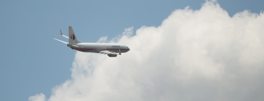
I used to work with Giovanni Di Stefano. What do you suppose happened to the Malaysian Airlines flight that disappeared….
Hi, do you know how can I get in touch with Giovanni? I am interested in Nino’s life